Helping teachers use geospatial technologies to transform education in NH
NH Educational GIS Partnership
  • About
  • News
  • Get support
  • Get involved
  • Equipment
  • Map Competition
  • ArcGIS Hub Site
  • Contact

Nexus Tablets at 2 Workshops!                                     by Bob Woolner

4/5/2015

0 Comments

 
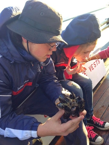
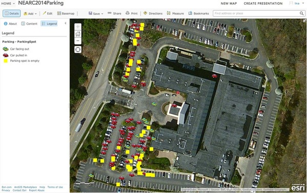
The set of tablets was on loan to Epping Elementary School teachers Kara Reynolds and Alyson Bates, as they wanted to try out the devices, in advance of a science unit on erosion. 4th grade students would soon be gathering data points, and taking geo-tagged photos of local erosion, and the teachers wanted to be sure that the devices would work as expected.

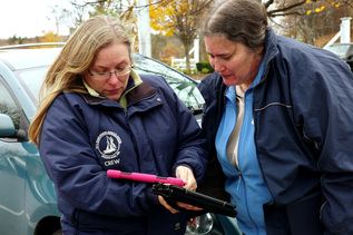
As I was planning to present at the New Hampshire Council For Social Studies workshop held on March 19th 2015 at the New Hampton School, I wanted to “borrow” them back, to ensure that they were charged and ready to use by teachers attending our presentation on ArcGIS online mapping for social studies. Kara and I arranged a “hand-off” using Marcel Duhaime (of Bow High School) as an intermediary drop off. I picked up the set from Marcel at his home in Bow, on Monday, March 16.

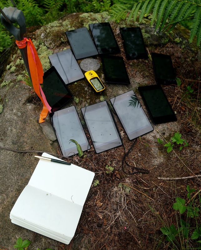
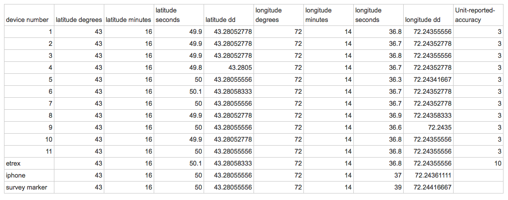
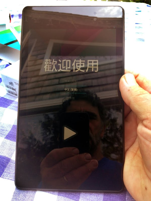
On Wednesday afternoon March 18th, the day before the NHCSS conference, the Nexus devices were all checked for updates (many required multiple updates. All devices were charged up, and safely stored away in the traveling suitcase.
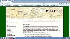
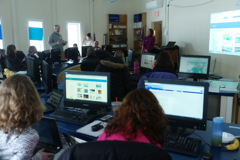
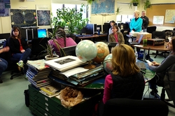
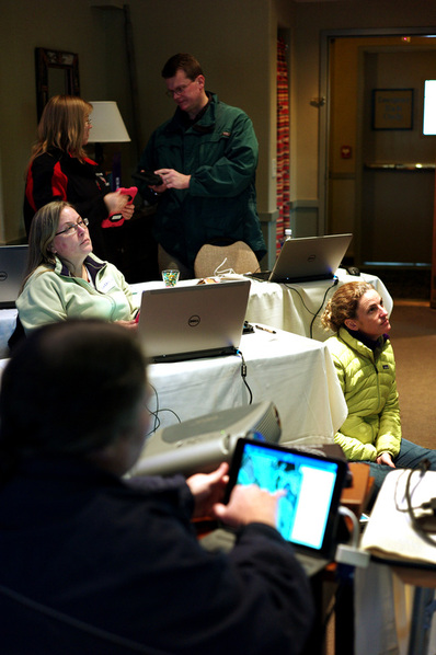
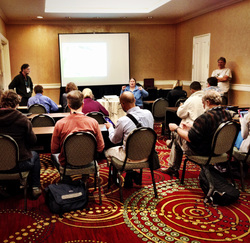
At the NHCSS conference, Matt Krogman (HMHS AP US history teacher) and I wanted teachers to use devices to examine ready-to-use history lessons that incorporate and leverage GIS to give students a geo-spatial view of what can sometimes be just dry historical statistics, usually presented in a spreadsheet or chart. Matt wanted teachers to see lessons as found on http://www.intimeandplace.org/.
Picture
Picture
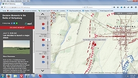
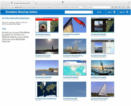
And I wanted to show teachers several “Storymaps” that had been produced by Esri and a few selected storymaps my own students have done in this past few years. As it turned out, most of the attending teachers had brought laptops or ipads with them, and so most were able to follow along on their own devices. But we did loan out 2 of the Nexus Tablets, and they worked fine. It is good to know that the browser interface on the devices was not an obstacle to successful use of that website. And the Storymaps were viewable as well. All went very well.

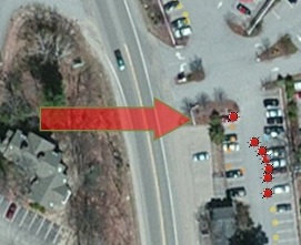
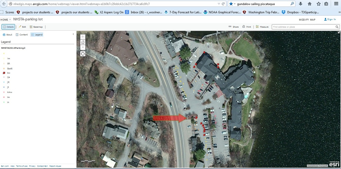
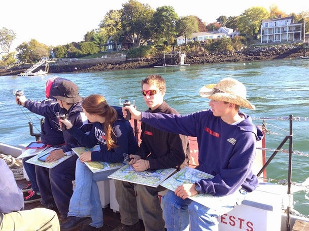
Also... we had a workshop scheduled for March 21 2015 ( the following Saturday) at the Unity Elementary School in Unity, New Hampshire. This Watershed Education Program Workshop was arranged by Judy Tumosa (New Hampshire Fish & Game) and Jen Thompson (teacher at Unity Elementary). We intended to do ArcGIS online mapping of watersheds in the morning, using desktop computers, and spend the afternoon creating simple storymaps of the area around that Unity school. We wanted to use the Google Nexus tablets to gather geo-tagged images, as that simplified the process of getting those geo-tagged images to an on-line storage site (such as Picasaweb).

Picture
Picture
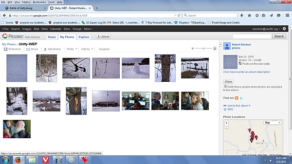
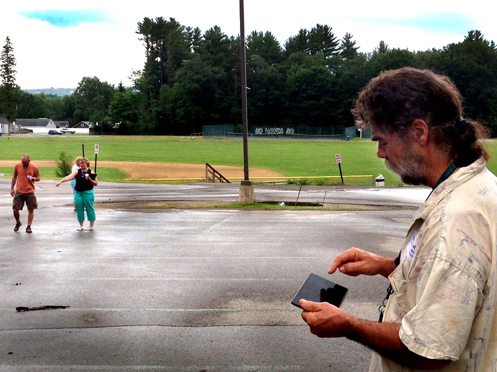
At that Saturday workshop in Unity, we had some issues with bandwidth- both hard-wired ethernet on the desktop machines in the morning, and even more so, with wireless connections of the Google Nexus tablets in the afternoon. But they did work. Teachers were able to use the tablets (and some used their own smart phones) to carry outdoors, walk the school grounds, take photographs of interesting objects and locations, all geo-tagged automatically by the gps-enabled Nexus tablets. Actually, 1 teacher found her images were NOT geo-tagged, as that singular device had the “location services” turned off. (We don't know why.) Back in the computer lab at that Unity school... the wireless connections were made, but... attempting to move the device-stored geo-tagged images from the devices to picasaweb proved next to impossible. Ultimately... most teachers did NOT succeed in transferring images. We fell back on “plan B”, which was utilization of a set of shared geo-tagged images that I had created earlier that morning.

Ah well. Another possible solution for the future- pull the images off the Nexus devices with a USB wire, by-passing the wireless connection ordinarily necessary.


0 Comments

Gundalow Story Map Gallery finally available!  by Ina Ahern

2/3/2015

0 Comments

 
Picture
It's taken a while, but the environmental science students at Plymouth Regional High School finally finished and shared their story maps from the fall trip around Portsmouth Harbor on the Gundalow.  Check out the actual gallery at:  http://bit.ly/16tXQR9
0 Comments

Sharing "Service Definitions" of Editable Feature Services  -  By  R. Scott Semmens

1/31/2015

0 Comments

 
I enjoy working with ESRI’s Collector app especially on my cell phone. Last summer I created an Editable Feature Service to use collecting track and sign data in South Africa. I set up 4 separate maps and used them to gather data under a variety of circumstances. I found the data points to be accurate - as long as I let the cell phone lock onto the satellites.

Using this classroom set of Google Nexus devices, I am currently experimenting with the Esri  Collector app for my classes at Hopkinton Middle High School. Naturally one of the nice features in using the Collector app is “crowd-sourcing” data. This allows students in the class to individually, simultaneously, collect data that can all be placed on the same final map.  This works fine, as long as students collect data from different areas or regions. If they are in the same area, different students might collect the same data points, which could be a problem.  Then again, you might want that.  For instance, I have students in my GIS and Natural Resource Management classes collecting the same data but in their different  groups and I didn’t want them to have one classroom  map with replicated data. I wanted each separate small group to have their own map with their own data. Each group would still be collecting the same data but each group would have its own final map and not aggregate the other groups' data onto one classroom map. Small group maps, and not a singular class-sized map would be the result.

I tried to remedy the problem by giving each group a copy of the Service Definition of the “Editable Feature Service”.  Which should work. I have seen during a workshop how one could publish someone else’s Service Definition, thus giving you a new Feature Service with no data entries. I quickly found that this only works if you do not belong to the same organization. If you make copies of the Service Definition and publish it as a Feature Service within the same organization, you will not be able to disaggregate the data. In other words it is still the same feature service as before. To remedy that problem, I found that I had to republish the original Feature Service using ArcMap, creating new Feature Services for each group, with a unique name... not just renaming the same Feature Service. This way each group has their own unique Feature Service. So far, this seems to work. I plan on using this technique when I am in South Africa , next summer, with my students.
Picture
Another problem that I am going to look into: I found the Google Nexus 7 tablets to have some issues with GPS point accuracy. Many times the data point is way off from where we were recording the information. There could be many factors leading to this: Students recording data too quickly after login into their maps – remember, you need to give the device time to lock onto the GPS satellite signal – or perhaps students are hovering over the tablet- thus blocking the signal -  or it could be an issue with the tablet itself.  A quick work around is to have the student “edit” the location of the data point after they record their data. This can work especially if you download sufficient detail for your map on the tablet.

0 Comments

   Christa McAuliffe Technology Conference      By BW

12/3/2014

2 Comments

 
We brought the little suitcase of Google Nexus Devices to the Christa McAuliffe Technology Conference, held in Manchester on December 3, 2014.  Ina Ahern and I were presenting a morning workshop titled Smart Maps Get Even Smarter! that made use of previously created, borrowable Editable Feature Services, and their use on hand-held devices (also borrowable), and we had planned/hoped for an opportunity to “go outside and collect data”.


We planned to gather data points and information about the parking behavior of conference attendees, and of other hotel guests, similar to the workshop that we did at the NEARC conference in Connecticut, the previous month.  However… when we considered our circumstances at the Radisson Hotel/Center of NH Expo Center, we realized that the nearby parking was in a multi-level parking garage.  We did not know if the Google Nexus devices would get satellite signals necessary for GPS location on the lower levels… and we knew that it would be impossible to manually map the inputs, as no image of the lower levels of the garage was geo-referenced.  After some thought… we decided to concentrate on the roof-top parking level.  Most problems would be sidestepped.


(Aside: in retrospect… I wonder, if we had been able to geo-reference a sketch/layout of the lower level parking… perhaps as separate maps? would that solve the problem?  Even without the GPS capability, the power of mapping manually would still be available… I think. But what about the multi-level nature of the garage?  Would we need another “field” named “Level”?  Or “elevation”?  Is there another way to account for data points that share latitude and longitude coordinates, but have different elevations?   Perhaps something to think about… and experiment with.)


As mentioned ,we had planned to walk out onto the parking garage roof to gather data points and information  Unfortunately… it snowed/sleeted/freezing-rained during the night before and during that early morning drive, and so our planned field trip was put in some jeopardy.  When it became time to take the session participants outside,  we walked down the stairs from the mezzanine level, out to the garage, up the elevator, and out onto the garage rooftop, crossing our fingers that icy conditions had moderated.  Luckily… they had.  We split up into 4 groups, and within 10 minutes, had gathered data points of the entire rooftop.
Picture
Back in the session meeting room, we demonstrated synchronizing the singular devices, combining all collected data points, and… displayed our group results.  Teachers were interested in doing similar classroom projects, and were very interested in the fact that these Google Nexus devices would be borrowable.  We think we made some friends!
2 Comments

EFS with KK in NH                                                                  by BW

11/10/2014

0 Comments

 
Picture
    Kathryn Keranen (KK) traveled to New Hampshire (NH) this past weekend, to conduct a workshop on Editable Feature Service (EFS) creation. (Do you understand the title of this blog now?)

Kathryn’s workshop provided the opportunity for the Cloud Connected Mapping Project team members to learn LOTS more about Editable Feature Services. While previously, we have been able to learn from each other... this gave us an opportunity to learn from the "best". Kathryn is currently the coordinator of the "Geospatial Semester" at James Madison University, and supervises hundreds of teachers throughout the Virginia region, who supervise and teach thousands of high school students in the Virginia region. Kathryn is also an instructor at the Esri's T3G institutes (Teachers Teaching Teachers GIS) at the Esri corporate campus located in Redlands, California. Kathryn knows her stuff. In addition, we were able to invite some other regional "power GIS users" to the workshop, and even more "in addition", we were able to invite some other newer NHEdGIS members, so as to introduce them to the power of ArcGIS Desktop.  Hopefully, these new participants will be some of the first "borrowers" of these Google Nexus devices.


Picture
The workshop began with ArcGIS Online,with a basic introduction to data collection using EFS by adding editable points to a “teacher info” map that Kathryn had created. Each of us then built our own individual EFS using ArcGIS Desktop, modeled on KK’s "Wifi Strength" service, which includes both date fields and domains that allow for pull down menus, which greatly simplifies data collection in the field.  We then added a graphic rectangle to the desktop project (you could use any shape!) and converted this graphic to a feature layer to designate a work area for students to use, when downloading/installing the maps on the mobile devices. Following that, we used the "Fishnet" tool to grid out the work area, for students to use when out in the field.  By labeling the grid with the numbers created through the Fishnet process, and then uploading this to ArcGIS Online as a "Tiled Map Service", and adding this new service to the data collection map (which also contains the EFS), the final complete data collection map, when opened on mobile devices (such as the Nexus devices) is set up so that student teams can be assigned to different specific easily identifiable areas. Cool!
Picture

After each of us had successfully uploaded our own newly created fishnetted EFS, we spent some time talking about techniques for sharing empty EFS using the service definition files.  KK generously made all her service definition files temporarily publicly accessible, and we found we could search ArcGIS Online for them and download copies of them, and then upload them to our own organization, therefore getting a blank copy of the EFS, ready to go and collect data.  This seemed to work very well, and also offers real promise for allowing us to create "generic" EFS to share with teachers who do not have the necessary skills (yet) to create their own EFS.


Picture
The workshop concluded with each participant working on individual projects as desired, with Kathryn available to assist with troubleshooting and answer questions.  Some participants created another editable feature service for their specific curriculum, some played with the Collector app on the Nexus devices, while others focused on using the analysis capabilities of ArcGIS Online to analyze data collected using an EFS.

And we filmed it!  Four 30-ish minute videos are now available below! .

All in all... this was a highly successful workshop for team members and we are hoping to bring Kathryn back next summer as part of the NHEdGIS 2015 summer institute series.


0 Comments

Mapping Parking Lot Behavior at NHSTA           by Bob Woolner

11/3/2014

1 Comment

 
Picture
Over this past weekend... I helped Ina Ahern present a workshop for the New Hampshire Science Teachers Association (NHSTA )in Meredith New Hampshire, held at the Church's Landing Inn on the shores of Lake Winnipesaukee. It was a bitingly cold day, with gusty wind to make it seem even colder.

In this particular workshop, we wanted to collect local data using an Editable Feature Service on local hand-held devices (Ipad Minis and the Google Nexus), and then, using that same feature service, on the return indoors, on laptops... gather some data of parking lot behavior in other pre-selected parts of the world.

  The 12 NHEdGIS-owned Google Nexus devices all had received fresh “updates” to their operating systems, so they were current as could be. In that previous week, I also had deleted (from all devices) the Esri Collector app that had been installed in June, before our Summer GIS Institutes. As previously mentioned, we sort-of felt that the accuracy of those Google Nexus devices seemed ...suspect. Before this workshop, I wanted to test the newest-latest-greatest most-up-to-date version of Collector, to see if accuracy seemed better.

And so... early in the morning, before the session began... I planned to gather some points carefully and slowly, paying attention to the collected points' accuracy.

I loaded the editable feature service map (created by Ina Ahern) to gather data points regarding the parking orientation of cars in parking lots in Meredith, New Hampshire. I turned off Wifi, and walked outside... to my own car, that I had parked near the entrance to the lot. Standing just 2-3 feet from the front bumper, I noticed that the floating blue blob was... accurate... (actually, very accurate) as I entered that first data-point of information on that 1994 white Volvo, that had been backed expertly, perfectly aligned, into the parking spot. (Did I mention it was my car?) Then I started walking south, approximately 2-3 feet from the rear (or front) bumpers of several cars, gathering data points, and entering data, and did NOT correct on the hand-held map, relying on the GPS signal that was being received by the Nexus. I noticed that as I walked south along that line of cars... the floating blue blob... drifted... slightly east, more towards the middle of the parking aisle. Still … within a car's length of the actual location.


Picture
Picture
   Later in the workshop, we went outside again, this time with other participants, and while they gathered data on Ipads and Google Nexus, I took photographs of them. And also took a few more points of my own. Again, I did not correct for location, and just allowed the floating blue dot to be placed … where it wanted to be placed. Only 1 of these collected dots seemed to be in the correct location. Interestingly enough... again... it was the first point collected. Hmmmm.... Again, all subsequent points were... shifted slightly south, or southeast.

Picture
I mentioned this odd “drift of accuracy” on the T3G listserv, and received some speculation, but still do not have an answer. I plant to again test the accuracy of these devices with my small advisory group next week, back here at Hopkinton Middle High School.

More later.
1 Comment

Gundalow Sailing with Nexus Devices -            18th Century Tech meets 21st Century Tech           By Ina Ahern

10/6/2014

1 Comment

 
October 6 2014- Students from the Plymouth Regional High School Environmental Science class spent the day with the Nexus devices, first working on invasive species at Odiorne Point State Park, and then sailing aboard the gundalow Piscataqua on a tour of Portsmouth Harbor.  During the gundalow sail students documented their experiences and learning with geo-located photographs taken with borrowed UNH Cooperative Extension iPads and the Google Nexus devices purchased through the NHSTE Chris Nelson Memorial Grant.  Many mobile devices owned by schools (such as PRHS) are “wi-fi only” devices that lack a GPS chip and therefore do not know where they are when they take a photograph unless actually connected to a network.  On land, sometimes this can be compensated for by the use of a detailed aerial photograph to locate the image site, but that doesn’t work so well on open water!   Hence, the critical need for these borrowable gps-enabled devices.  Students will be assembling these images into an Esri Map Tour Storymap to document their activities that day. (Links will be posted to the blog when these student projects are finished.)  In the meantime, here’s a few images taken that day.
Picture
Picture

Upon return to the dock, students were able to assist in swabbing down the deck with salt water, an important task to help preserve the wooden gundalow.  Perhaps on our return to school, we could look at the cafeteria... (Photo courtesy of Lena MacLean)

Picture
1 Comment

Nexus Tablets Map Cars @ NEARC GIS Educators Day(by Ina Ahern)

10/5/2014

0 Comments

 
Picture

GIS Educators Day is a pre-conference held each year the Sunday before the Northeast Arc Users (NEARC) Fall Conference.  This year the conference was held in Mystic, CT; and NHEdGIS team members presented and co-presented many of the sessions.  One of the final hands-on sessions of the day, and also one of the best attended was “Using Esri’s Collector App for Field Data Collection with Your Students.”  This session focused on using mobile devices (the Nelson Grant Nexus devices and UNHCE iPads) to collect data on parking practices and answer questions raised by the article http://www.npr.org/2014/08/27/343623220/parking-behavior-may-reflect-economic-drive

As the workshop was only an hour in length, it was critical that the mobile devices be prepared ahead of time.  This presented our first challenge.  Judy Tumosa (NH Fish and Game) and I arrived at the Mystic Marriott, had a quick dinner, and then began individually preparing each device.  First Challenge:  Although in-room Internet access was free, you are only allowed to connect 3 devices per room.  A problem when in addition to your laptops you have 15 iPads and 12 Nexus Devices all of which need to be prepped for the workshop.  Solution:  The hotel lobby has free wireless available.  Grab the suitcase of Nexus Devices (Nexi?) and the suitcase and bag of iPads and take the elevator down to the lobby.  Fortunately, this hotel lobby had a wonderful long table with desk chairs set up that was just perfect for the task at hand.  In addition each leg of the table had two electric outlets, which in combination with the power strips we brought let us work on charging the devices at the same time.  Now to load the devices.  Judy and I set up next to each other and began….enter the passcode for the device.  Connect to the wireless.  Launch a browser and agree to the terms.  Launch the Collector app.  Sign in to the NHEdGIS ArcGIS Online organizational accounts with one of the generic Publisher accounts.  Find the NEARC Parking Map.  Zoom in to the Mystic Marriott Parking Lot.  Set work area.  Zoom in as far as the map will allow.  Set map detail.  Download map.  Select the option to download new basemap….select aerial imagery.  Leave that device downloading and move onto the next.  When the map is downloaded, return to the first device and open the map.  Make sure everything is working and then let the device go to sleep.  About this time Margaret Chernosky, a fellow T3Ger and good friend from ME arrived and volunteered to help.  With three of us working, we were able to get all the devices prepped in short order.  We did learn a few things:

1.  Zooming in to your own school is easy….you know what it looks like from the air.  Zooming in to a hotel in different state is a bit more challenging.  Within the download area of the Collector app there’s no search option.  Initially, we brought the area up in a web browser on the laptop, and then used that to help us locate the right area.  Finally we figured out that if we entered one data point on the map at the hotel location, we could easily see that when we went to download…..so much easier and faster!

2.  If you don’t get the download right the first time, it’s a problem to try again.  For example, if you select too small a work area or forget to download the new aerial imagery for that area there’s no “Try Again” option.  That night, we couldn’t figure out how to get rid of the map at all, so what we ended up doing was signing out of ArcGIS Online with that particular Publisher account, and then logging back in as someone different.  Since then I’ve been told it is possible to delete the map off the device, but have yet to play with that.

Thanks to Margaret’s and Judy’s help, we finally had all the devices ready to go and were able to carry them back up to the room.  By unplugging practically every other device in the hotel room, we were able to get all the ones that were not fully charged plugged in so they would be ready for the morning.  I have to admit, it sure was a lot easier dealing with the 27 mobile devices in three small “suitcases” then it would have been with a similar number of laptops.  I think the largest mobile laptop lab I ever set up was 18, and I barely managed to get them all in my car without any passengers!


Our workshop began with an introduction by Bob Woolner (Hopkinton Middle High School) and then some sample data and maps collected and prepared by Scott Semmens (Hopkinton Middle High School) from his Africa trip.  In addition to his cool images of tracks, he was able to emphasize the real advantage of collector….being able to collect data while disconnected and then syncing to the map when Internet access is available again.  Bob then introduced today’s data collection project and I demonstrated how to collect a data point using the Collector app on an iPad.  It was at this point that it occurred to me we really needed to have the ability to project the Nexus device as well.  Although the process is the same, the tools, menus, and placement of items is a little different on Android OS and in the future it would be great to be able to project both screens side by side so each participant will be able to see exactly what they need to do.  In this case, when we first went out, we just made sure that all those using the Nexus Devices had one of our trusty co-presenters along with them while they collected the first few points.  (In addition to those mentioned above, special thanks to Shane Bradt of UNH Cooperative Extension and Marcel Duhaime of Bow High School for providing this support.)

Picture
Given the short length of the workshop, participants only had about 15 minutes to collect data.  Upon return to the meeting room, data was synced and participants and facilitators alike were amazed at the quantity of data that was collected in such a short time.  Although we didn’t have time for analysis, options were discussed, and will be explored at our next Cloud Connected Mapping workshop taking place at the New Hampshire Science Teachers Association fall conference on November 2nd.  As a four-hour field trip, this workshop will allow participants to not only collect data, but also to go through the process of setting up the mobile device for data collection.  Also coming up on November 8th is our Editable Feature Service workshop with Kathryn Keranen.  For more information on either of these, check out the postings to the NHEdGIS Collaborative Ring at http://www.nhedgis.org/collaborative-ring.html

0 Comments

Getting to know the Google Nexus ever better

8/16/2014

1 Comment

 
Update of the past few weeks.  As mentioned, I decided that some "in the field" protection for the devices was needed.  After some research on-line and discussion with current users/owners, I decided on notebook-like covers, such as offered by www.thesnugg.com.  I contacted Sammie Mercer (customer service), who helped me decide on the version to purchase (I needed the Google Nexus 7 series 2 version),  which I then ordered.  

Sammie was able to offer me a significant discount as I made a bulk purchase- and the cases were going to be used by a public school.  The cases arrived quickly, were unpacked, un-wrapped, and the Nexus devices were slipped into the slots, secured by a wrap-around-velco closing tab.  This is a very nice design- especially as the case has an elastic band sewn through the backing, which allows the user to one-hand-hold the device securely, while the other hand is free to enter data. 

I also ordered 15 thin plastic screen protectors- actually, I ordered these screen protectors in 3 different batches from some ebay retailers- thereby getting wicked good deals.

Another update- we tried using 3 of the Google Nexus devices during a Summer Institute field trip to the Bow Knox-Road-School Forest.  1 lost it's basemap- I don't know how, and the user did not have the admin password to try downloading another version.  The other 2 never really displayed an accurate location- at least , when running the ArcGIS Collector app.  This needs further investigation.  

It may be that the devices needed time to settle down and get an accurate "fix", or it may be that the devices have a setting that needs tweaking- or it may be that there is a flaw in the Collector app- I do know that the devices themselves are accurate, at least while using the GPS Essentials app.

Another update- Rebecca Lilja (US Forest Service) borrowed one of the devices over this past weekend August 8-9-10,  to test during a GPS "field day" event at the University of New Hampshire.  She determined that they are accurate- AND... was able to solve another mystery.  Garmin GPS units generally display 10 or 11 or 12 satellites that are "viewable" at any given moment.  However, the Google Nexus devices display...26!!!  

How is that possible?  One half of all 26 GPS satellites are on the other side of the planet at any given moment... Well.  These Google Nexus 7 devices seem to have a GPS chip that is capable of seeing not only the United States' satellites, but also the Russian GPS satellites! Cool!

1 Comment

"X" marks the spot

7/20/2014

0 Comments

 
I downloaded data from GRANIT.unh.edu, and located a geodetic survey marker nearby to our camp in Acworth, NH.  Visually on the map, it is located just south of the intersection of North Shore Road and route 10 (Second New Hampshire Turnpike), in the town of Unity, New Hampshire.  According to the obtained data,  it is located at 43 degrees 16 minutes 50 seconds, and 72 degrees 14 minutes 39 seconds.  I drove to the approximate location, parked on the side of the road, and started searching around, on the southwestern corner of that intersection- eventually I found the marker, placed in a large boulder that is also serving as an anchor point for a nearby power pole. 
Geodectic control marker
I turned on all 11 Nexus devices, turned on a Garmin Etrex GPS, started up Motion GPX on my smartphone... and got out my notebook and pen.  A light drizzle-shower interrupted me briefly, when I ran for a towel in the car... and eventually all the devices settled down, and I was able to jot down readings from all devices.  I set all to report degrees/minutes/seconds, as that was how my data reported the survey marker.  
Gadgets galore!
The latitude decimal degree column and the longitude decimal degree column are calculated, from the device-reported degrees,minutes,seconds data.  Also, it should be pointed out that the latitude readings are N, and the longitude are W. To be used in an GIS map, the decimal degree longitude numbers would be multiplied by -1 (negative 1).  The unit reported accuracy on all Nexus devices was 3, which is 3 yards radius.  The reported accuracy of the Garmin Etrex is 10 feet radius.  I don't have a reported accuracy for the iphone Motion GPX app.  Note the only discrepancy is the survey marker!!!   I wonder if I should get in touch with the USGS.  On the other hand... these hand-held devices are set to WGS 1984 datum.  The marker states it was reset in 1966.  I wonder... if that could explain the discrepancy of just-more-than 2 full seconds of longitude.
Picture
I think... I will revisit the site, and set waypoints there, to check if the stored data (stored waypoints) is kept in decimal degrees, as the Garmin Etrex does.  (Even though the Garmin Etrex is set to read-out degrees/minutes/seconds, it stores the data as decimal degree.) And then I will re-set the Nexus devices to read-out decimal degrees, and re-write those read-outs, to compare the accuracy compared to the set above.  And I need to check how to access the internally stored waypoints (and tracks).  Pulled off with a cable?  E-mailed out to... someone?  Vulcan mind-meld? Magic?  More later.
0 Comments

The Google Nexus in action

7/16/2014

1 Comment

 
We just completed the 3rd of our 7 Summer Institutes related to GIS- and I had a chance to try out a couple of the Nexus devices, using an Editable Feature Service (EFS) in ArcGIS Collector.  It was raining off-and-on throughout the day, but we grabbed 30 minutes in the middle of the afternoon to go outside and collect GIS referenced data- specifically, oil spots on parking spots in the Hopkinton Middle High School (HMHS) parking lot. 
Bob marking oils spots with the Google Nexus
We were successful in logging onto the devices, successful in downloading a basemap of the EFS using the school wifi connections... we were not as successful in collecting the data.  Because the oil spots were obscured on the rain-wet asphalt, the 3 of us using the Nexus devices had to more-or-less make up pretend data as we walked along the parking lot.  

In addition, the device that I was carrying did NOT have accurate GPS readings, regularly reporting poor GPS reception, and never getting accuracy better than "somewhere in a 66-foot radius".  It may have been the drizzle, it may have been the saturated clouds, but Nexus device #1 was never accurate.  And both Nexus device 8 and Nexus device 3 (I have numbered them for identification) seemed to get more accurate GPS readings... they both suffered from other connectivity issues.  Specifically, both of those devices continuously connected to the building WIFI, or TRIED to connect to the building WIFI, causing the mapping/gathering of data to stop functioning while the WIFI attempted to connect.  So some data collection was lost.  

Still... we collected data with I-pads, a few smart phones and... 3 Google Nexus 7 devices- here is a map Marcel Duhaime (math teacher from Bow High School) made with that shared EFS data...

View larger map
Walking around the rain-slick parking lot with these Nexus devices, these slippery, thin, hard-to-hold devices...shielding them from drizzle... comparing them to the expensively-rubber-clad-in-waterproof-cases UNH Cooperative Extension I-pads that others were carrying... made me realize we really need to consider adding some protection to these Nexus devices.  I plan on researching to find something within our budget constraints.

Also, I intend to test all 11 devices for accuracy over the coming weekend, when it will be sunny, clear and dry.  I packed them all up in a newly acquired hard-shell small suitcase (that will soon be outfitted with foam lining), and will report back on the GPS accuracy testing. With regards to the connect/disconnect to WIFI issue, we decided it can be solved by simply turning off WIFI when "out of the building".  An elegant solution!  So, some more testing, some more research and some more tweaking is planned for the weekend.
1 Comment

Cases

7/12/2014

1 Comment

 
I have located 11 neoprene sleeves to contain the devices, and am considering some scheme to acquire an appropriate sturdy shock-resistant shipping case, so that we could re-allocate some of those funds to purchase better “in the field” cases to protect the individual devices from accidental knocks and bangs and bruises and drops.  It seems to me, the real risk to these devices is NOT during storage and/or transit/shipping.. .but rather, during actual individual use in the field.  THAT”S where we should concentrate our efforts for protection.  More about that later.
1 Comment

Finally... we're back to 11 again.

7/9/2014

2 Comments

 
Again… the Concord store had none in stock… the near-to-my-camp Claremont store had none in stock. I emailed to Walmart.com to ask procedure, the auto-reply told me to “return the device” to the store, and re-order through online.  So… I made plans to return the device, and re-ordered the replacement before actually returning (to save a trip) and … again… the ordered on-line device was “ready for delivery” within minutes of ordering.  Clearly, there is a distinction with the stores, and they don't talk to each other.  “out of stock on the shelf” doesn’t really mean “out of stock in the building”  I drove to Claremont NH, returned the mostly-dead Google Nexus. ( All right, so maybe the device is only mostly dead… still, it would take a miracle to bring it back.  I returned it).

After the successful return, I visited the Walmart.com area at the back of the store, and picked up my ordered-on-line 11th Google Nexus 7 device.  (We opened the box there, and turned it on.  It worked.  Excellent!)

2 Comments

Mostly dead?

7/6/2014

1 Comment

 
Of the 11 devices, 1 totally refused to power-up / turn-on.  I tried reading online about similar situations involving the Google Nexus, and found that MOST users with dead devices are able to “jump start” the battery with a short charging… followed by unplugging… counting to 15, plugging back in… and turning on the device.  This trick didn’t work.  I found another story of charging for 1 hour, and then doing the same… that didn’t work either.  I found another story whereby the owner dis-assembled the sealed Nexus, and disconnected the battery briefly... and this supposedly revived the device.   (“Whoo-hoo-hoo, look who knows so much. It just so happens that your friend here is only MOSTLY dead. There's a big difference between mostly dead and all dead. Mostly dead is slightly alive.” )   I decided AGAINST that idea, and … decided to return that 11th device.
1 Comment

Loggin in

6/30/2014

1 Comment

 
Matt suggested we set up a new email account in the name of a generic nhedgis-student, and then… set up all 11 devices so that they start up with that same log-on.  He also discussed the possibility of having a password-locked administrator-log-on to the devices, along with a semi-locked nhedgis-student account, and I am still investigating that possibility.  It “locks down” the capability of the typical student user, and maintains a student-friendly log-on homepage with readily accessible-but-limited supply of apps… and I think that is the way we will eventually go.  But it requires some tweaking, so that all needed capabilities are turned on and available, while other distractions are turned off appropriately.  More to do here.
1 Comment

Setting up the devices

6/29/2014

0 Comments

 
I un-boxed the first device, and walked slowly through the setup procedure- (How did it know I have an interest in understanding Chinese???  Oh, that's right- Google knows all...)   After setting the language to English (United States variant)... it sure seemed like the device really really really wanted me to have a Google account.  Should I sign in to my own Google email account???  Would that give all students a view of my own emails?   Could we know that all students would have their own gmail account?  I was unsure of the best procedure to use, to make the devices be accessible to a variety of students in a variety of schools… so I re-boxed that single device, and made an appointment with Matt Stone.  (He knows his google-stuff- I think he has a Google-doctorate.)
Waking up a Google Nexus
0 Comments

Time to get the tablets!

6/24/2014

0 Comments

 
Picking up the Google Nexus tablets
The purchase of 11 Google Nexus devices required a bit of research- we wanted tablet-devices that would have wifi capability… have GPS capability…  be affordable, easy-to-use, perhaps intuitive, and interesting/desirable/enticing.  Discussion with Matt Stone, our district SAU66 technology director led me to a decision to purchase the 2013 version of the google Nexus 7, as that device had all of those qualities.  With the choice narrowed down, researching price led me to Walmart.com, with an online cost of 189.00 for each unit.

After clicking on the “add to cart” button  , I was able to change the quantity to… 5.  Only 5.  Hmmm… I wanted 11.  I tried… purchasing again, and did add another 5 to the cart, now totaling 10.  Unfortunately, I had also accidentally added an additional warranty to that purchase of 5, and so… while I did have 10 in the cart… I also had that un-wanted extra warranty.  But try as I might, I could NOT add an 11th device to the purchase cart.  So… I shrugged and mentally agreed to purchase only 10, at least on that first go-around.  But first, I needed to delete the un-wanted extra warranty.  I soon realized I could not isolate the warranty to delete- I needed to delete that entire package of 5 with the warranty.  Okay.  Delete.  Then I re-made the purchase of 5 again (this time without the warranty)… and I found I could NOT get that added to the cart!!!    5 was the maximum number I could get in the cart.  Time to call Customer Service.

There is no phone number listed on the Walmart website...

Time to call Walmart the store.  Concord had none in stock and were completely un-helpful. Claremont had none in stock… but the salesman there gave me the telephone number for Walmart.com (on-line sales) customer service.

After waiting on hold for 15 minutes… the first salesperson told me they COULD help me add 10 devices to the cart… but they could NOT help me, because I did not have a Walmart Online account.  So I hung up, and created an online account... added 5 to my cart... tried to add another 5... and failed.  Still only 5.  I called Walmart.com again… another 15 minutes of on-hold time...and I found myself connected to a different customer service representative. But even with her friendly help, we still could not get the cart to accept more than 5.  So… she advised me to purchase them in batches of 5 (plus an additional 1) to total the needed 11), and have all batches shipped to the Concord store.  Okay.  Good idea.  She offered to “do it for me.”.  Agreed.  We added the first batch of  5 to the cart, she took my VISA number and … the VISA was rejected.  Tried a second time… fail again.  Hmmm… I decided to hang-up and try on my own.

Starting fresh, I added 5 to the cart… purchase..  VISA failed for me.

I called VISA.  On hold for 10 minutes… “Why are you rejecting my VISA purchase?”  “Oh, that is normal.  Anytime a large purchase “out of the ordinary pattern” happens, we reject it. It’s a feature, not a problem”.  “.....”    “Do you want me to authorize that purchase?”   “Yes.  And I intend to purchase 5 more, and then 1 more after that.  Can you make sure you will authorize the unusual “out-of-the-ordinary-pattern” purchase of 11 Google Nexus devices, in 3 separate batches, from Walmart.com?”

I logged back onto Walmart.com, and made 3 separate online purchases of 5 Google Nexus 7 devices. Success, all 3 times.  Remember… Concord told me they had none in stock?  Within 4 minutes of the 3 separate on-line purchases, I received 3 emails telling me that the devices were ready for pick-up at the Concord store.  Hmmmm…..

30 minutes later… the telphone rang.  “Good morning, this is Chris, calling from Walmart.com. How are you today sir?  We have an unusual purchase from you that I would like to follow up on- Did you order 3 separate orders of Google Nexus 7 devices… a total of 11 devices?  It’s unusual… we wanted to make sure it wasn’t a mistake.”  I assured him the 3 separate batch purchases of 11 was intentional.

2 days later, I drove to Walmart on Loudon Road in Concord NH and picked up the 11 devices, and walked out of the store!
0 Comments

    Cloud Connected Mapping

    Picture
    Learn more about Cloud Connected Mapping and the NHSTE Chris Nelson Memorial Grant that supports this work.

    Archives

    April 2015
    February 2015
    January 2015
    December 2014
    November 2014
    October 2014
    August 2014
    July 2014
    June 2014

    RSS Feed

    Bob Woolner

    Bob Woolner

    I am a Geography! teacher at the Hopkinton Middle High School in Contoocook, NH.

    Join me as I explore how Google Nexus tablets can  be used to help teachers and students get involved in Cloud Connected Mapping.

NHeon.org  |  NH Department of Education  |  NH Fish & Game Department   |  NH Geographic Alliance |  UNH Cooperative Extension