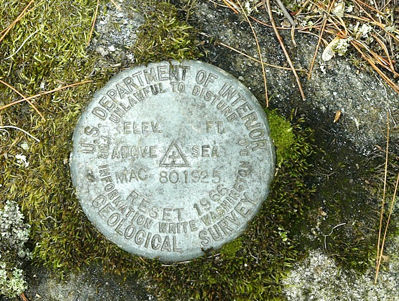
I downloaded data from GRANIT.unh.edu, and located a geodetic survey marker nearby to our camp in Acworth, NH. Visually on the map, it is located just south of the intersection of North Shore Road and route 10 (Second New Hampshire Turnpike), in the town of Unity, New Hampshire. According to the obtained data, it is located at 43 degrees 16 minutes 50 seconds, and 72 degrees 14 minutes 39 seconds. I drove to the approximate location, parked on the side of the road, and started searching around, on the southwestern corner of that intersection- eventually I found the marker, placed in a large boulder that is also serving as an anchor point for a nearby power pole.
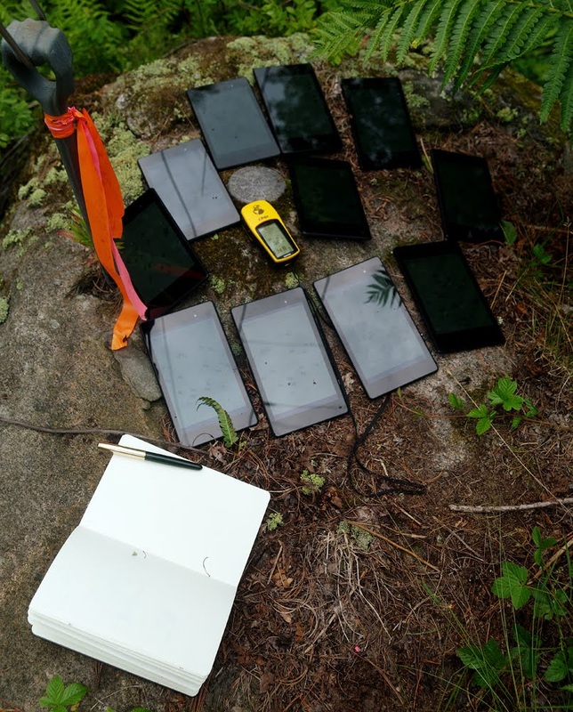
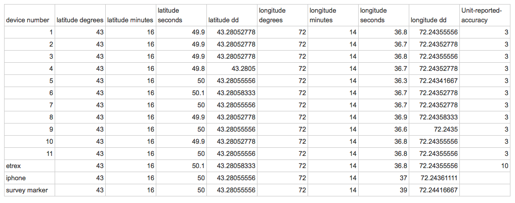
I turned on all 11 Nexus devices, turned on a Garmin Etrex GPS, started up Motion GPX on my smartphone... and got out my notebook and pen. A light drizzle-shower interrupted me briefly, when I ran for a towel in the car... and eventually all the devices settled down, and I was able to jot down readings from all devices. I set all to report degrees/minutes/seconds, as that was how my data reported the survey marker.
The latitude decimal degree column and the longitude decimal degree column are calculated, from the device-reported degrees,minutes,seconds data. Also, it should be pointed out that the latitude readings are N, and the longitude are W. To be used in an GIS map, the decimal degree longitude numbers would be multiplied by -1 (negative 1). The unit reported accuracy on all Nexus devices was 3, which is 3 yards radius. The reported accuracy of the Garmin Etrex is 10 feet radius. I don't have a reported accuracy for the iphone Motion GPX app. Note the only discrepancy is the survey marker!!! I wonder if I should get in touch with the USGS. On the other hand... these hand-held devices are set to WGS 1984 datum. The marker states it was reset in 1966. I wonder... if that could explain the discrepancy of just-more-than 2 full seconds of longitude.
I think... I will revisit the site, and set waypoints there, to check if the stored data (stored waypoints) is kept in decimal degrees, as the Garmin Etrex does. (Even though the Garmin Etrex is set to read-out degrees/minutes/seconds, it stores the data as decimal degree.) And then I will re-set the Nexus devices to read-out decimal degrees, and re-write those read-outs, to compare the accuracy compared to the set above. And I need to check how to access the internally stored waypoints (and tracks). Pulled off with a cable? E-mailed out to... someone? Vulcan mind-meld? Magic? More later.


 RSS Feed
