
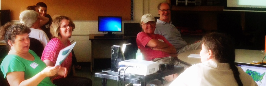
What is the NH Educational GIS Partnership?
The NH Educational GIS Partnership is a group of people and organizations who believe geospatial technologies have the power to enhance K-12 education in the state of New Hampshire. Through the efforts of the partners, staff at the New Hampshire Department of Education, and Esri's K-12 Education Team; an agreement has been reached that will provide Esri's ArcGIS software to all K-12 schools, teachers, and K-12 age youth groups in the state for educational and administrative purposes.
What organizations lead the Partnership?
While many groups and organizations participate in the NH Educational GIS Partnership, the institutional members are described below.
Founding members
|
NH Department of Education
The New Hampshire Department of Education (NHDOE) is committed to helping students, parents, and educators (including teachers, principals, superintendents, and school communities) meet the educational needs of each student. NHDoE supports teachers in NH with online resources for GIS-specific information through this webpage. |

|
NH Geographic Alliance
The mission of the New Hampshire Geographic Alliance (NHGA) is to engender an awareness, appreciation, and understanding of the fundamental importance of Geography, its spatial perspectives, and its vital relationship to our lives. NHGA promotes an increase of and diffusion of geographic literacy in New Hampshire by communicating with, building relationships to, and providing opportunities for educators, educational decision makers, and institutions of education. |
|
NH Fish and Game Department
As the guardian of the state's fish, wildlife and marine resources, the New Hampshire Fish and Game Department works in partnership with the public to:
|

|
UNH Cooperative Extension
The UNH Cooperative Extension Geospatial Technologies Training Center (GTTC) works to promote the understanding and use of geospatial technologies by a wide range of sectors in New Hampshire, including K-12 teachers, academia, state/local/regional/federal government, non-profit groups, small business and volunteers. The GTTC provides instruction on GIS, GPS, Google Earth, and online mapping through a combination of online courses, in-person workshops and free downloadable training materials. |
Supporting members
|
US Forest Service
Primarily aimed at the 20 states served by the Northeastern Area and Washington, D.C, the mission of the Conservation Education program from the US Forest Service is to help educators connect their students to the land by providing them with the training and tools they need to engage those students’ interest. |

|
NH Educators Online
The goal of this website is to bring together educational resources in NH that are pertinent to educators, as well as, the expertise and knowledge that NH educators have can be showcased. The website provides resources for meeting the proficiencies, a venue for teachers to exchange and share ideas, a tool for educators, and a way of keeping up-to-date on professional organizations. |

|
Keene State College
Keene State College supports GIS education throughout the state by housing the NH Geographic Alliance. In addition, Keene State College provides academic credit for the Summer Spatial Institutes. |
Learn more about Esri
"Esri is an exciting company doing important work. Our technology enables organizations to create responsible and sustainable solutions to problems at local and global scales. At Esri, we believe that geography is at the heart of a more resilient and sustainable future. Governments, industry leaders, academics, and nongovernmental organizations (NGOs) trust us to connect them with the analytic knowledge they need to make these critical decisions that shape the planet." Esri president, Jack Dangermond