The set of tablets was on loan to Epping Elementary School teachers Kara Reynolds and Alyson Bates, as they wanted to try out the devices, in advance of a science unit on erosion. 4th grade students would soon be gathering data points, and taking geo-tagged photos of local erosion, and the teachers wanted to be sure that the devices would work as expected.
As I was planning to present at the New Hampshire Council For Social Studies workshop held on March 19th 2015 at the New Hampton School, I wanted to “borrow” them back, to ensure that they were charged and ready to use by teachers attending our presentation on ArcGIS online mapping for social studies. Kara and I arranged a “hand-off” using Marcel Duhaime (of Bow High School) as an intermediary drop off. I picked up the set from Marcel at his home in Bow, on Monday, March 16.
On Wednesday afternoon March 18th, the day before the NHCSS conference, the Nexus devices were all checked for updates (many required multiple updates. All devices were charged up, and safely stored away in the traveling suitcase.
At the NHCSS conference, Matt Krogman (HMHS AP US history teacher) and I wanted teachers to use devices to examine ready-to-use history lessons that incorporate and leverage GIS to give students a geo-spatial view of what can sometimes be just dry historical statistics, usually presented in a spreadsheet or chart. Matt wanted teachers to see lessons as found on http://www.intimeandplace.org/.
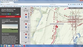
And I wanted to show teachers several “Storymaps” that had been produced by Esri and a few selected storymaps my own students have done in this past few years. As it turned out, most of the attending teachers had brought laptops or ipads with them, and so most were able to follow along on their own devices. But we did loan out 2 of the Nexus Tablets, and they worked fine. It is good to know that the browser interface on the devices was not an obstacle to successful use of that website. And the Storymaps were viewable as well. All went very well.
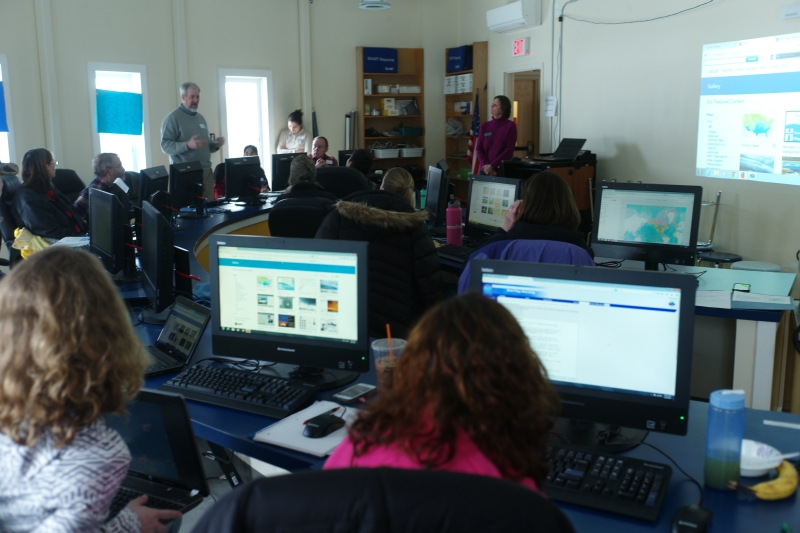
Also... we had a workshop scheduled for March 21 2015 ( the following Saturday) at the Unity Elementary School in Unity, New Hampshire. This Watershed Education Program Workshop was arranged by Judy Tumosa (New Hampshire Fish & Game) and Jen Thompson (teacher at Unity Elementary). We intended to do ArcGIS online mapping of watersheds in the morning, using desktop computers, and spend the afternoon creating simple storymaps of the area around that Unity school. We wanted to use the Google Nexus tablets to gather geo-tagged images, as that simplified the process of getting those geo-tagged images to an on-line storage site (such as Picasaweb).
Also... we had a workshop scheduled for March 21 2015 ( the following Saturday) at the Unity Elementary School in Unity, New Hampshire. This Watershed Education Program Workshop was arranged by Judy Tumosa (New Hampshire Fish & Game) and Jen Thompson (teacher at Unity Elementary). We intended to do ArcGIS online mapping of watersheds in the morning, using desktop computers, and spend the afternoon creating simple storymaps of the area around that Unity school. We wanted to use the Google Nexus tablets to gather geo-tagged images, as that simplified the process of getting those geo-tagged images to an on-line storage site (such as Picasaweb).
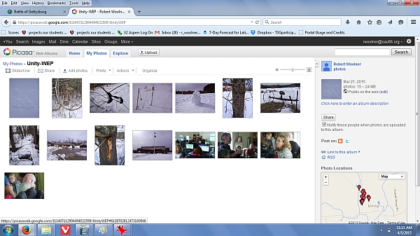
At that Saturday workshop in Unity, we had some issues with bandwidth- both hard-wired ethernet on the desktop machines in the morning, and even more so, with wireless connections of the Google Nexus tablets in the afternoon. But they did work. Teachers were able to use the tablets (and some used their own smart phones) to carry outdoors, walk the school grounds, take photographs of interesting objects and locations, all geo-tagged automatically by the gps-enabled Nexus tablets. Actually, 1 teacher found her images were NOT geo-tagged, as that singular device had the “location services” turned off. (We don't know why.) Back in the computer lab at that Unity school... the wireless connections were made, but... attempting to move the device-stored geo-tagged images from the devices to picasaweb proved next to impossible. Ultimately... most teachers did NOT succeed in transferring images. We fell back on “plan B”, which was utilization of a set of shared geo-tagged images that I had created earlier that morning.
Ah well. Another possible solution for the future- pull the images off the Nexus devices with a USB wire, by-passing the wireless connection ordinarily necessary.
Ah well. Another possible solution for the future- pull the images off the Nexus devices with a USB wire, by-passing the wireless connection ordinarily necessary.


 RSS Feed
