
GeoPriSM Community Atlas Projects
|
Geospatial Projects in Science and Math (GeoPriSM) is a NHEdGIS-led project funded through New Hampshire’s Math-Science Partnership (MSP) program and hosted by the lead partner Hopkinton School District, SAU66.
|
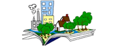
What is a Community Atlas Project?
In the GeoPriSM Community Atlas Project, students work together to produce and share a web-accessible project that provides a community profile of a specific area of interest. The community could be their home community (neighborhood, town, county, state, watershed, etc.) or an area of special interest to them (Odiorne Point, Cardigan Mountain State Park, Strawberry Banke, etc.). Although we anticipate that most Community Atlas projects would focus on a local home community, it is possible to focus on another area if that better meets curriculum needs (Jerusalem, for example in a Middle Eastern studies class).
2015 & 2016 & 2017 Community Atlas Projects
2015 & 2016 & 2017 Community Atlas Projects
What pieces make up a Community Atlas Project?
The project must include maps and text, and will likely include images, but can be presented in a variety of formats, depending on the topics explored and technology utilized. The project should be designed to tell a cohesive story, but can make use of a wide variety of technologies, such as web pages, web maps, presentations in web maps, Esri storymaps, etc. Basic information about the project and a link to it will be included on the Community Atlas page on the GeoPriSM website.
A GeoPriSM Community Atlas Project requires:
A GeoPriSM Community Atlas Project requires:
- 10-20 (min-max) different maps.
- Text/captions totaling 1000-3000 words (but please be concise!)
- As many images necessary (remember, this is a mapping project)
- defining community
- achieving consensus
- research
- conciseness
- Register
- Define the focus & boundaries
- Create an assignment for your students (with their input)
- Distribute Rubric and discuss expectations
- Decide on presentation method(s)
- web page,
- web apps,
- presentations,
- storymaps,
- final “map gallery”
- Submission due by June 8 , 2018.
What is GeoPriSM?
What are the benefits for being part of GeoPriSM?
How do NH teachers participate in GeoPriSM?
What are the benefits for being part of GeoPriSM?
How do NH teachers participate in GeoPriSM?