GeoPriSM Community Atlas Workshop - Minutes/Notes - January 31 2015 10:00am - 4:00 pm
Hopkinton Middle High School
Instructors: Ina Ahern, Lara Bryant, Rebecca Lilja, Bob Woolner
Participants: Laurel Bates, Paul Bolduc, Debbi Cox, Marcel Duhaime, Anne Guerriero, Maya Hardcastle, Marilyn Knapp, Pam LaFountain, Bethany Poulin, Kara Reynolds, Judy Tumosa, Carol Ward
Participants: Laurel Bates, Paul Bolduc, Debbi Cox, Marcel Duhaime, Anne Guerriero, Maya Hardcastle, Marilyn Knapp, Pam LaFountain, Bethany Poulin, Kara Reynolds, Judy Tumosa, Carol Ward
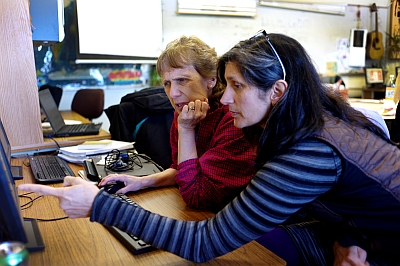
Welcome from Ina and review of the agenda.
“GeoPriSM Participant Agreement” Forms: http://www.nhedgis.org/uploads/2/4/1/3/24132478/geoprism_participant_agreementv3.pdf
Ina asked the teachers to commit to the GeoPriSM project. This is a NHEdGIS-led project funded through a NH Math-Science Partnership (MSP) grant. We need to collect signed forms from participants. Lara is processing the student info and it will be anonymous. If teachers did not do it this year, can do it next, it is voluntary.
Expectations of Community Atlas Project: It is a requirement of participating in GeoPriSM. Ina would like all teachers to do Community Atlas if they can and it is doable and fun. The format has changed because ArcGIS Online (AGO) capabilities have changed.
Description of Community Atlas (Community Atlas requirements are on the NHEdGIS webpage: http://www.nhedgis.org/geoprism-community-atlas-projects.html):
Classes of students are expected to produce:
Ø 10-20 maps
Ø with images - use what you need in support of your project and maps.
Ø and text (1,000-3,000 words per project). Text such as captions, descriptions of maps are in support of the community project.
Ø Categories of projects: community, historical, conservation.
Ø Students can develop their own or teacher can configure what works in that class. Students need skill in defining their own project and reaching consensus and gathering of info (research). Students learn to use the technology as a tool.
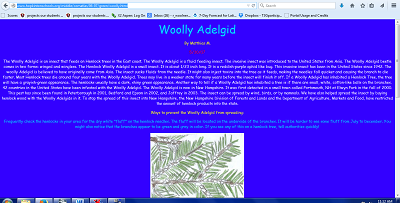
Bob showed “not concise” version – students had free rein and then it was edited down to fit Esri’s old requirements.
To Register for the Community Atlas Project: https://docs.google.com/forms/d/1p9ycZZagJFT0ss679YPEcNFaIj7atn0gEirpHz3gNNE/edit?usp=sharing
Deadline: Deadline for Community Atlas projects will be first week of June, teachers can continue to edit after submitting it. NHEdGIS team members need time to evaluate and submit final project analysis by the end of July. Teachers need to submit a link to their project and the link will be on the NHEdGIS website under GeoPriSM. The project can be used as an end of the year culmination project or if you finish before then, please submit earlier. Outside evaluators for the grant will visit some schools and talk to teachers.
To Submit your Community Atlas Link: https://docs.google.com/forms/d/1A0brhTHTMF9TQqiJk2PlDXDxbKd4rvXQxzGGyDRfyvA/edit?usp=sharing
Reward: The first 20 teachers that submit completed accepted projects get $400.00 as long as signed the Participation Agreement and follow the protocols. Teachers also get credits for $10.00/hour for participating in training sessions. Teachers need to commit 40 hours of training during summer and 20 hours of training during school year.
Topics: very broad
Description
History
Conservation
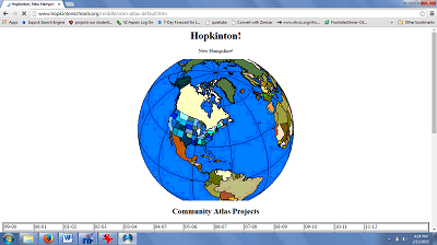
Examples to be shown, old way:
Bob:
Hopkinton! Student Community Atlas Pages - Available with web link. All different topics- some are Invasive species topic info (words), images, sketches, and maps.
Ina:
Plymouth, Squam Lakes – too many pixels for pictures, too many maps, too small to read, too much description but students learned, html document
Odiorne Point: page on Ina’s website and projects are there, then needed to do ArcGIS Explorer online, no longer supported, maps, popups embedded, too much text, digitized by hand – layer exists now, embed web links, animations from NASA
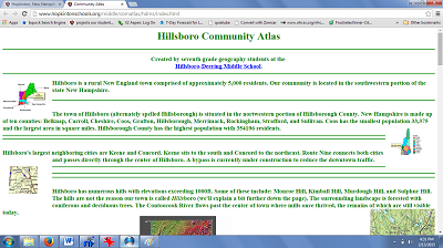
Melissa Robbins (Hillsboro-Deering):
One single web page with electronic maps on it
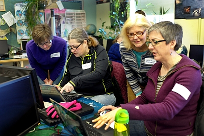
Teachers discussion and exploration, connected to web link to see examples of Community Atlas projects: http://bit.ly/1yjLt0M (other link for one that didn’t work: /18DiRtw) Updated link to “fixed document: http://bit.ly/1zyc4Kr
Think about:
Ø Content
Ø How teachers grouped their students
Ø How your students can do better
Think about:
Ø Content
Ø How teachers grouped their students
Ø How your students can do better
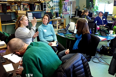
Rebecca:
Provided a shortened version of her “How to make A Community Atlas project” webinar. Link to the webinar recording: http://bit.ly/1Kd3aol
Googling Esri_landscapes will get you access to many natural resource layers. Rebecca demonstrated creating groups, (2nd period science class…) and then create gallery.
Marcel:
Demonstrated a collection of maps of all that you can do with AGO to answer a question (theme): are there enough fire stations based on current stations, travel time, etc., Portsmouth Harbor Forts, Bow Crime Data, Runoff, polygons of Turee Pond, Invasive Species, with Map Journal, EFS.
Advised that teachers test the links by sending it to someone, eliminate your web address and just give the link for the map or you will have to sign into their account
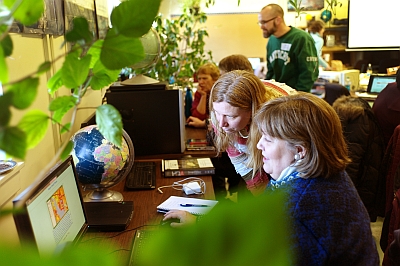
Classroom management:
Ø Students take charge of different parts of the project but cannot work on same map at the same time.
Ø Each can create their own map journal and then put it into a gallery.
Possible formats to use:
Content Type
ArcGIS Online Maps
Web Map App (requires that you have an AGO Map to make an App)
Storymaps- such as:
Journals
Map Tour
Simple web apps
Presentation Format:
In a gallery
Linked from one to another
Embedded maps and text in a website
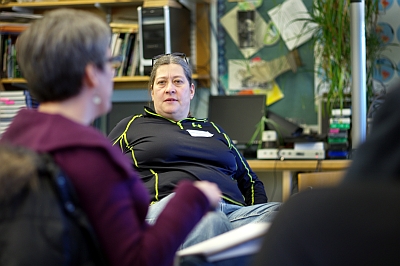
Brainstormed in random groups and reported out:
What topics would you pursue as your community atlas project?
Ø Locations in the community
Ø Weather
Ø Connect two different schools
Ø Shopping locations
Ø Swipey map with Osprey populations now and before
Ø Swipey map with current and past climate info - change
Ø Earth surface features, take pictures with GPS, connect picture to feature, each group of students with picture and blurb; logistics about multiple groups work on project at same time
Ø Collect data within school with map – food wrapper waste to see who had the least wrappers so where do you need the recycling container?
Ø Blister rust historic maps
Classroom Implementation Standards: (Lara)
Lara discussed ArcGIS and geography curriculum connections to:
Ø NH Curriculum Standards based on Geography standards, connecting Geography for Life to the elements of fiction, such as understanding spatial location of literature
Ø Process based projects best for using with the connections
Ø Alignment Guide connecting ELA Common Core State Standards to the Geography for Life National Standards; http://bit.ly/18XZpSA
Ø NGSS examples provided (handouts and websites) to connect English and mathematics to geography, maps, spatial location and cross-cutting concepts, place based, cross curricular
Ø Satisfy more than one standard
Two skills to consider
1) Geospatial technologies to collect, interpret, analyze and visualize data
2) Design authentic geospatial technology-based assessments that provide students with opportunities to apply what they’ve learned and mirror practices and products of real-world science.
Classroom Management: Discussion
Bob
4 mixed classes, 14-20 students per
Chose topics then always pairs them, self-selected based on interests
Brainstorming can be directed, suggestions
Work on one map, not at the same time, can do research in google, and then bring to AGO
Ina
One class, three groups, on three topics
General discussion and they sort groups and choose topics themselves
Story Maps – individual projects, Ina assigned a piece of content, drop into gallery and kids imbed map links on class Google site
Marcel
Help students identify problem and then they choose map to use to tell the story
Work through little projects to get comfortable; teachers demo map notes, story map, map journal, analysis – culminates in Community Atlas project
Other teachers/organizations request a map
Other classroom management issues:
Medium – ipads work, google chrome books work well
Things happen too fast for a lot of info, show kids by example and then let them go
Search for tool
Organize things for grading – google site each student has a page with links to the student’s embedded map, link app, save as jpg, bring onto page, link it and then can open up the map (Ina demo)
Paper rubric with link to project
Privacy issues for publishing school work, various school policies and options, screen shot would be ok, generic emails
Potential afternoon sessions to assist teachers to:
Design their own templates for ‘classroom Order of operations”
Get through organization setup and maintenance
Other suggestions for helpful topics?
Design their own templates for ‘classroom Order of operations”
Get through organization setup and maintenance
Other suggestions for helpful topics?

